Real-time hazard reporting for safer cities
About Project
The app makes reporting and validating environmental hazards more efficient. Users can quickly document issues such as unusual smells, smoke, noise, leaks, or illegal dumping, attach photos and short descriptions, and submit them for administrator review.
Once verified, reports are immediately forwarded to local authorities for proactive action. Meanwhile, users can view all active hazards on a real-time map and plan their routes accordingly.

Problem
People often noticed environmental issues but had no clear or convenient way to report them, unsure whether to call the city administration or specific services. As a result, many hazards went unreported, authorities reacted slowly, and communities simply avoided problem areas instead of helping resolve them.
Solution
A user-friendly app would let people actively participate in resolving issues: capture and submit hazards within seconds. At the same time, authorities would receive up-to-date information for faster and more proactive responses.

Benefits of HaZapp App
Clear Reporting Flow for Observers
A simple and intuitive process helps users quickly capture hazards and submit them within seconds.


Faster Response from Municipal Departments
Verified reports give response teams immediate access to the essential details — including photos and exact location.
Better Awareness for People in the Area
A real-time hazard map allows citizens to plan safer routes and avoid affected areas while the issue is being resolved.


Shared Environmental Responsibility
By contributing observations, both citizens and regulatory teams help reduce harm to the community and the environment.

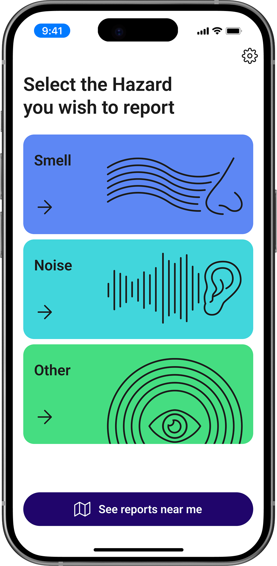
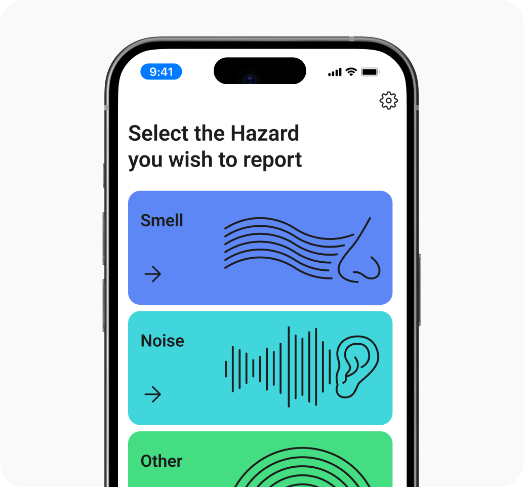
How it works
Users select the type of hazard (e.g., smell, noise, leak) and specify when it started and how strong it is.
All inputs — hazard type, intensity, location, and photos — are shown in a single summary screen for quick confirmation.
They can describe the issue, note any effects they experience, and attach photos for better clarity.
With one tap, the report is sent for admin review, and once accepted, forwarded to the relevant municipal services.

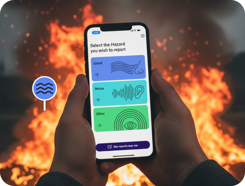
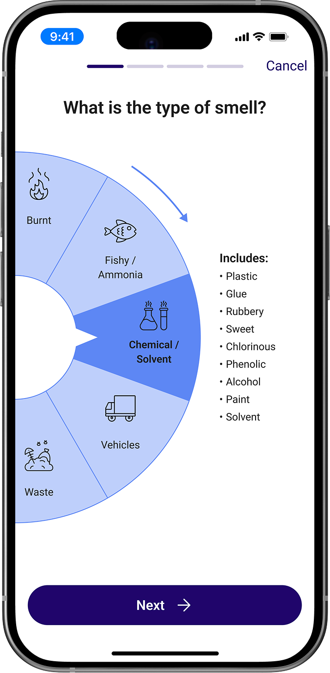
Smell Report
Unpleasant or unusual smells can signal chemical leaks, waste issues, vehicle emissions, or other environmental risks. In HaZapp, users follow a guided flow where they select the smell type, indicate when it began, rate its intensity, and add any relevant details.
Before HaZapp, people had no idea which service to call about unusual smells. The app provides a channel for reporting.
The smell-reporting flow guides users through everything authorities need — type, duration, intensity, location.
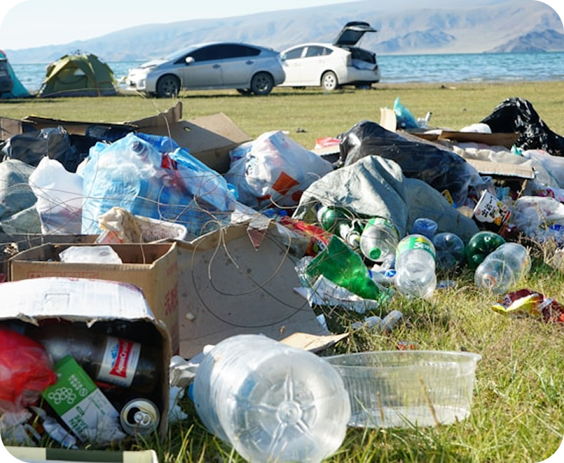
Users can attach photos (waste piles or nearby sources), helping response teams quickly understand the issue and react.


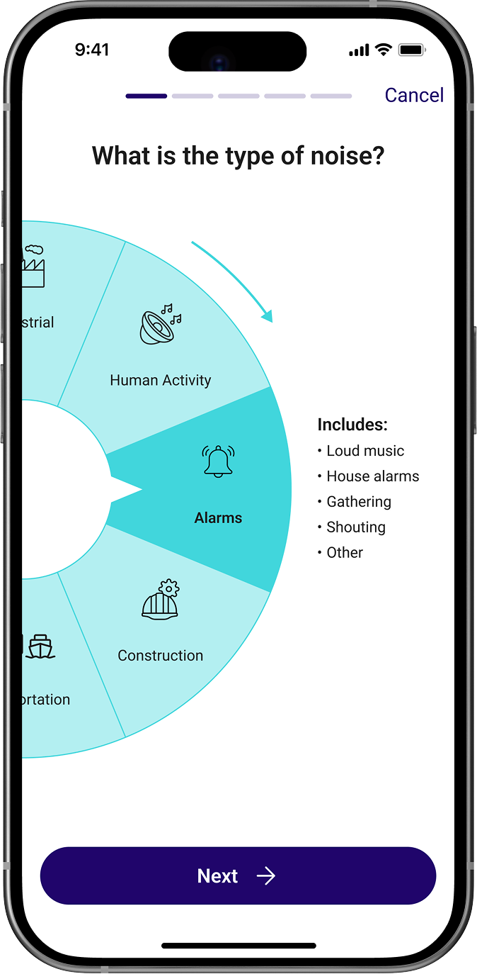
Noise Report
Excessive noise from construction sites, traffic, gatherings, or late-night parties can seriously affect comfort and safety in residential areas. In HaZapp, users follow a guided flow to specify when the noise started, how intense it is, and what type of source it may come from.

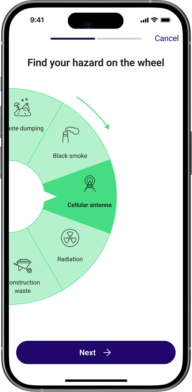
Pollution Report
Potential radiation exposure or signs of contamination can appear in many forms — suspicious materials, damaged equipment, abnormal readings, or visible environmental pollution.
- Users select the specific hazard type from the wheel for accurate classification.
- They add brief observations to clarify what was noticed on-site.
- Photos can be uploaded to provide clear visual evidence.

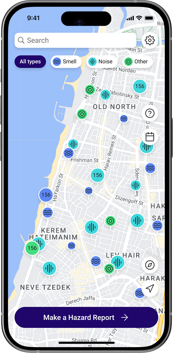
Real-time map of hazards in the area
The map displays all current verified hazards, helping users stay aware of environmental conditions around them and avoid affected areas until the issue is resolved.


Admins can review, approve, and redirect all incoming complaints in one streamlined interface.

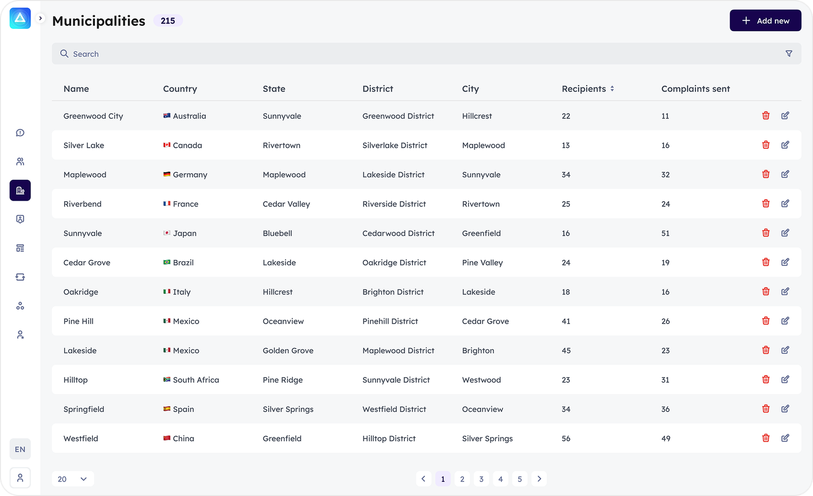
Admins can configure municipalities, assign responsible recipients for each area, and track how many complaints were forwarded to each team.

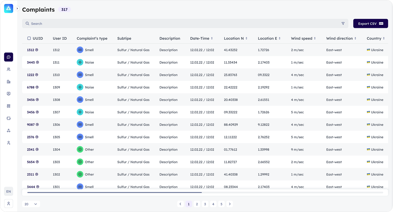
Admins can export complaints, user lists, and municipality data to CSV, enabling structured reporting, data sharing with local services, and deeper analysis in external tools.
Complaints page
A full overview of all submitted reports. Admins can quickly review, verify, and track each case. Every entry includes detailed info such as type, timestamp, location, and user data, making it easy to monitor trends and coordinate actions with municipal services.

Overview of registered users
Admin gets full visibility into user activity, helping them track who is actively submitting reports, identify suspicious or inactive accounts, and manage access.


Municipalities page
Every report is immediately routed to the right responsible person; local teams react faster, addressing issues as soon as they appear.
Download App
Early alerts prevent major hazards
Responsible services can receive an alert and head to the location immediately.
Clear overview of all regions
Admins get a structured view of every municipality and see which areas receive the most reports.
Templates for fast response
Admins can set up predefined email messages for different incident types and locations, allowing municipal teams to receive clear, structured alerts without delays. The template feature also supports multiple languages to ensure fully localized communication.

Final results

Faster Hazard Identification
Users submit reports in seconds, giving municipalities earlier visibility into issues that previously remained unnoticed for hours or days.
More Accurate & Complete Reports
Photos, location data, noise measurements, and structured fields give municipal staff all necessary details without requiring follow-up clarification calls.


Increased Citizen Engagement
A simple reporting flow and a live map encourage people to participate actively in solving local problems instead of ignoring or bypassing them.